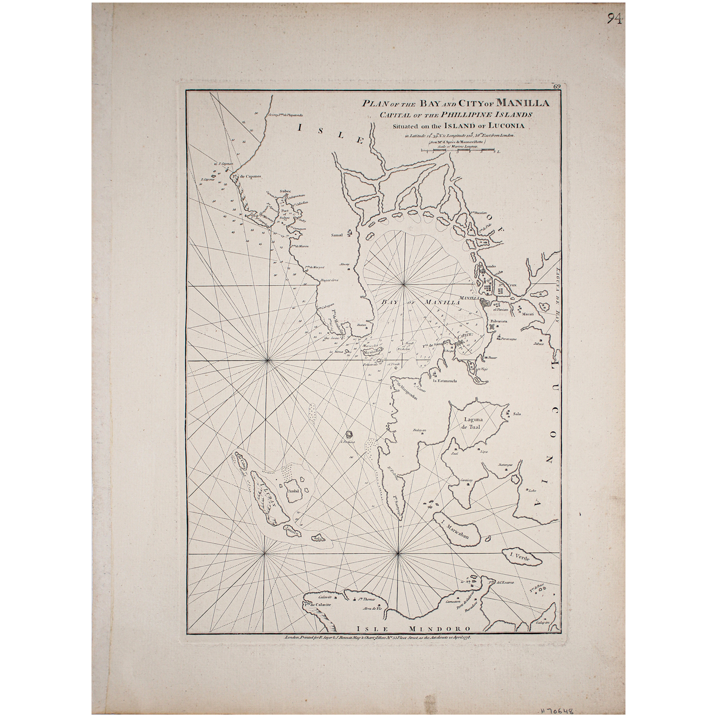
Very rare engraved chart of the Bay of Manila and surrounding areas, published by Sayer and Bennett in London in 1778. The chart depicts Manila, as well as nearby villages and forts of Cavite, “el Paxian” (Parian), Macati (Makati), Polvorista, Paravaque (Para?aque), Sta Crux (Sta. Cruz). Binondo, Jacubo, and Tondo. The map extends north of “Subec”. Corregidor is called “Mariveles or Mirabella Island”. Rarity: The chart is exceptionally rare. The last time this chart was on the market was in 1986.
Your Inquiry was successfully sent, please wait for the reply of Leon Gallery Management.
Sayer & Bennett
Plan of the Bay and City of Manilla (sic), Capital of the Phillipine (sic) Islands situated on the Island of Luçonia (sic)
1778
London
Uncolored
Very Good Condition
19” x 13” (48 cm x 33 cm)