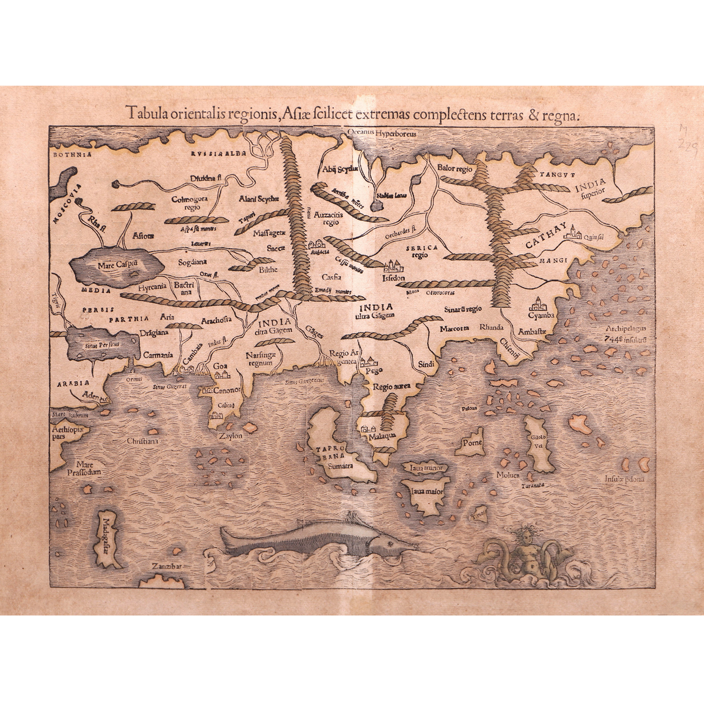
With Marco’s Polo’s view of the Philippine Islands Sebastian Munster (1488 – 1552) was a German cartographer and cosmographer who’s work, Cosmographia, would be the most extensive mapping of the Asian continent from the Caspian Sea to the Pacific Ocean and from the Arctic Ocean to the Indian Ocean. Munster relied significantly on Portuguese maps and their recent discoveries including Vasco de Gama to map out India with the outposts Calicut and Goa, Sri Lanka and all the way east to Malacca. The Moluccas and Java. The first edition of Cosmographia in 1540 did not have a more detailed rendering of the islands north of the Moluccas except one island named Puloan which could be Palawan. The rest are scattered islands about and Munster uses Marco Polo’s assertion that there are 7448 islands in an archipelago. That would be confirmed 14 years later with Giovanni Battista Ramusio’s map of Southeast Asia, with one island named, Filipina, for the first time, after Prince Philip of Spain. Cosmographia with its numerical description of the islands would be the first to herald the presence of the Philippines as well as that of Formosa, Japan, and the many more islands that dotted the “undiscovered” Pacific Ocean.
Your Inquiry was successfully sent, please wait for the reply of Leon Gallery Management.
Sebastian Munster (1488 – 1552)
(Tabula orientalis regionis, Asiae scilicet extremas complectens terras et regna)
1550
hand-colored
12 1/2” x 16” (31 cm x 40 cm)